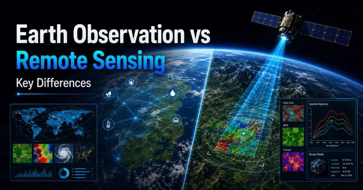
Earth Observation vs Remote Sensing is a distinction that trips up even experienced GIS analysts and researchers. Both terms appear frequently in academic literature, project proposals, and satellite data catalogs, often used interchangeably. Yet they represent different scopes, methodologies, and operational philosophies.
Understanding where they overlap and where they diverge matters when you're selecting data sources, designing workflows, or communicating with stakeholders who may not share your technical vocabulary.
For anyone working with satellite image analysis, getting this distinction right shapes everything from procurement to publication. This article compares the two across four key dimensions so you can use each term with precision.
Key Takeaways
- Earth observation focuses specifically on monitoring our planet using spaceborne and airborne platforms.
- Remote sensing is the broader scientific discipline encompassing any non-contact measurement technique.
- Both disciplines rely heavily on GIS mapping and spatial analysis for deriving actionable insights.
- Choosing the right term affects grant applications, data partnerships, and interdisciplinary communication.
- Modern satellite image analysis increasingly blends both concepts into integrated operational workflows.
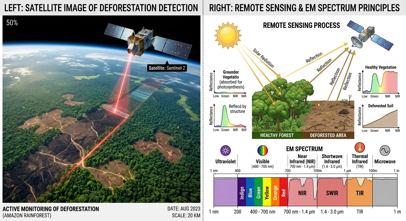
Scope and Definition: What Each Term Actually Covers
Earth Observation Defined
Earth observation (EO) refers specifically to the gathering of information about Earth's physical, chemical, and biological systems through spaceborne or airborne platforms. The European Space Agency's Copernicus programme is perhaps the most recognizable EO initiative, producing petabytes of free data annually from its Sentinel satellite constellation. EO is inherently planetary in focus. Every sensor, every mission, every dataset targets some aspect of our world's surface, atmosphere, or oceans.
The EO community has traditionally organized itself around thematic domains: land monitoring, marine environment surveillance, atmospheric composition tracking, and climate change detection. These domains drive how agencies like NASA, ESA, and JAXA design missions and allocate funding. When a researcher says they work in "earth observation," they typically mean they study planetary phenomena using overhead imagery and derived products.
Remote Sensing Defined
Remote sensing, by contrast, is the broader scientific discipline of acquiring information about an object or phenomenon without making physical contact. This includes satellite imagery of Earth, but it also covers planetary science (imaging Mars or Jupiter's moons), medical imaging applications, and industrial inspection techniques. Understanding how remote sensing works in satellite image analysis reveals just how expansive the field really is. The electromagnetic spectrum is the shared foundation.
Remote sensing as an academic discipline predates the satellite era. Aerial photography from balloons and aircraft during the early 20th century laid the groundwork. The discipline encompasses the physics of electromagnetic radiation, sensor engineering, signal processing, and image interpretation. It is a methodology first, an application second. This is the fundamental philosophical difference from EO, which is always application-driven and Earth-focused.
When writing grant proposals, use "Earth observation" for ESA and EU-funded programs and "remote sensing" for broader scientific and engineering research councils.
Technology and Data Sources
Platforms and Sensors
Earth observation platforms are almost exclusively satellite constellations and aircraft. Landsat, Sentinel, MODIS, and commercial operators like Maxar and Planet dominate the landscape. These systems carry optical, radar, thermal, and hyperspectral sensors specifically calibrated for terrestrial targets. Sentinel-2, for example, was designed with 13 spectral bands optimized for vegetation analysis, water quality assessment, and land cover classification.
Remote sensing technology extends well beyond these orbital systems. Ground-based LiDAR scanners, handheld spectrometers, sonar systems for bathymetric mapping, and even drone-mounted thermal cameras all fall under the remote sensing umbrella. The discipline also includes active sensing technologies like synthetic aperture radar (SAR) and passive systems that simply record reflected or emitted energy. Advances in 3D technology are also influencing how point cloud data from LiDAR is processed and visualized within remote sensing workflows.
Data Formats and Pipelines
EO data typically flows through well-established pipelines. Satellites downlink raw data to ground stations, which process it into standardized levels (Level-0 through Level-3). Agencies distribute these products through platforms like the Copernicus Data Space or NASA's Earthdata. GIS analysts can access analysis-ready data (ARD) that has been geometrically corrected, atmospherically compensated, and projected into standard coordinate systems. This standardization makes EO data relatively accessible.
Remote sensing data, given its broader scope, arrives in far more varied formats. A LiDAR point cloud from a terrestrial scanner has a completely different structure than a multispectral satellite image or a ground-penetrating radar profile. Processing pipelines vary dramatically. The analytical rigor remains consistent across remote sensing subdisciplines, but the toolchains, software, and storage requirements diverge significantly. Comparing standardized approaches in other domains, such as static analysis versus manual review workflows, illustrates how different methodologies can coexist within one field while serving distinct purposes.
Not all remote sensing data requires GIS software for analysis. Medical and industrial remote sensing applications use entirely different toolsets.
Applications and Use Cases
Earth Observation Applications
Earth observation drives some of the most impactful environmental monitoring programs on the planet. Deforestation tracking in the Amazon Basin relies on Sentinel-1 radar and Sentinel-2 optical data combined. Urban sprawl mapping uses time-series analysis of Landsat archives stretching back to 1972. Agricultural agencies monitor crop health, predict yields, and detect drought stress using NDVI and other vegetation indices derived from EO satellites. These applications share a common thread: they all concern Earth's surface and how it changes over time.
The policy dimension of EO cannot be overstated. International agreements on climate change, biodiversity loss, and disaster response depend on EO data for verification and enforcement. The Paris Agreement relies on satellite-derived emissions monitoring. Flood response agencies use near-real-time EO imagery to coordinate evacuations. When it comes to land pattern detection using satellite imagery, EO provides the backbone data that enables spatial analysis at regional and global scales.
"Earth observation is where remote sensing meets planetary stewardship, and its policy implications extend far beyond the laboratory."
Remote Sensing Applications
Remote sensing applications span an extraordinary range. In geology, airborne hyperspectral surveys identify mineral deposits without drilling a single borehole. In archaeology, LiDAR has revealed hidden Mayan cities beneath dense jungle canopy in Guatemala and Belize. Medical thermography uses infrared remote sensing principles to detect circulatory abnormalities. These examples demonstrate how the remote sensing methodology transfers across completely unrelated fields.
Within the geospatial community, remote sensing provides the theoretical and technical foundation for nearly all image-based analysis. Spectral unmixing, texture analysis, object-based classification, and change detection algorithms were all developed within remote sensing research. GIS professionals who work with GIS mapping techniques for Earth observation data are applying remote sensing science whether they label it as such or not. The discipline provides the "how" while EO provides the "what" and "where."
Earth Observation vs Remote Sensing for GIS Professionals
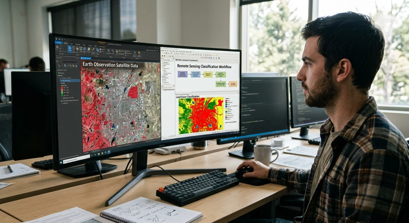
For GIS analysts and researchers, the distinction between Earth Observation vs Remote Sensing has practical daily implications. When you integrate satellite imagery into a GIS workflow, you are performing Earth observation if your focus is terrestrial monitoring, and you are applying remote sensing techniques to do it. The two labels describe different layers of the same activity. Recognizing this helps you communicate more precisely with colleagues in adjacent disciplines, from atmospheric physicists to urban planners.
Career specialization increasingly depends on understanding this nuance. Academic programs in Europe tend to emphasize "Earth observation" in their naming conventions, reflecting the ESA-driven research ecosystem. North American universities more commonly house their programs under "remote sensing" departments, often paired with geographic information science. Both traditions produce skilled analysts, but the terminology signals different professional networks, funding sources, and publication venues.
| Criterion | Earth Observation | Remote Sensing |
|---|---|---|
| Primary Focus | Earth's surface, atmosphere, oceans | Any target, any distance |
| Driving Philosophy | Application and policy oriented | Methodology and science oriented |
| Typical Platforms | Satellites, aircraft | Satellites, aircraft, ground, lab |
| Key Agencies | ESA, NASA, JAXA, NOAA | IEEE, ASPRS, ISPRS |
| Data Standardization | High (ARD, CEOS standards) | Varies widely by subdiscipline |
| GIS Integration | Native and widespread | Common but not universal |
| Academic Home | Geography, environmental science | Engineering, physics, geography |
In practice, most professionals operate at the intersection. You might use remote sensing algorithms (spectral classification, SAR interferometry) on Earth observation data (Sentinel-1, Landsat-9) within a GIS platform (QGIS, ArcGIS Pro). The boundaries blur in daily work, and that is perfectly fine. What matters is understanding which label to use in which context: "remote sensing" when discussing methodology and sensor physics, "earth observation" when discussing applications, policy, and planetary monitoring.
Include both terms as keywords in your academic publications and project metadata to maximize discoverability across both communities.
The convergence of these fields is accelerating. Cloud computing platforms like Google Earth Engine and Microsoft Planetary Computer blend EO data access with remote sensing processing at scale. AI-driven analysis tools increasingly abstract away the sensor-specific details, letting analysts focus on geographic questions rather than radiometric calibration. For researchers entering the field, fluency in both vocabularies is no longer optional. It is a baseline professional competency that determines how effectively you collaborate across institutional boundaries.
Using the terms interchangeably in formal proposals or academic papers can signal a lack of domain expertise to reviewers.
Frequently Asked Questions
?How do I choose the right term in a grant proposal?
?Is Copernicus Sentinel data considered remote sensing or EO?
?Does switching between the two terms slow down a GIS project?
?Is it wrong to use Earth observation and remote sensing interchangeably?
Final Thoughts
Earth Observation vs Remote Sensing is not a competition between rivals but a distinction between scope and method. Earth observation tells us what to study; remote sensing tells us how to study it. GIS analysts and researchers benefit from understanding both dimensions, using the right term in the right context.
As satellite constellations grow and AI-powered analysis matures, these two traditions will continue merging in practice while maintaining their distinct identities in academic and policy circles. Master both vocabularies, and you will navigate the geospatial world with greater confidence and credibility.
Disclaimer: Portions of this content may have been generated using AI tools to enhance clarity and brevity. While reviewed by a human, independent verification is encouraged.